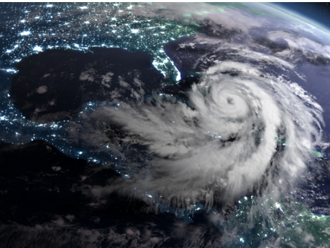
As natural disasters become more frequent, dynamic location technology is more essential than ever
For first responders, emergency planners and communities, geographic information system (GIS) technology is uniquely capable of aggregating the data needed to respond to disasters swiftly and recover from disasters with maximum resiliency.
By WP Creative Group
SEPTEMBER 1, 2023
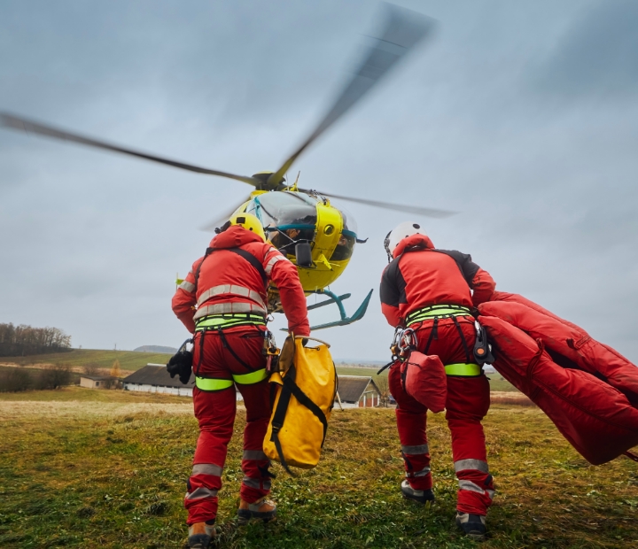
When a 7.8-magnitude earthquake rocked southeastern Turkey and parts of Syria on the morning of February 6, 2023, it left a path of destruction, and started a race against time to locate missing people, pets and property. For a coalition of thousands of rescue workers from around the globe, it demonstrated what the response to a giant natural disaster increasingly looks like: rapid, adaptable, data-rich and orchestrated through state-of-the-art mapping technology.
This was “[t]he largest search-and-rescue mission ever conducted [in the EU and it] relied on maps…to make sure that all those decisions made in the field were being reflected back in real time,” said Ryan Lanclos of Esri, the world’s leader in GIS technology, at a recent Washington Post Live Event. Armed with geographic data, rescue teams and decision makers can better coordinate and seek additional resources to recover as quickly as possible. Lanclos, who heads national government and public safety solutions, added, “That’s the future of disaster response—technology is there to lend a helping hand.”
Digital maps are helping communities recover more quickly after natural disasters by addressing tough questions before they happen. When a hurricane strikes or wildfire spreads, where exactly should emergency aid go first, and how? If people are injured or displaced, what’s the fastest way to reach them? Who will be most vulnerable in the next disaster, and why?
“GIS, as a technology, can really help look at complexities that are not just about the natural systems…but also the social and economic potential impacts,” said Lanclos.
GIS unites information on a single living map to help diverse groups of stakeholders—rescue workers, government officials and community members—speak a common language. By tying together geospatial data and visualizing trends into edifying insights, shared location intelligence helps make informed, holistic decisions that can save lives and accelerate recovery.
Rescue and recovery
The GIS-powered hub combines real-time weather forecasts, information on evacuation routes and shelter locations and a way for residents to report damages to their homes. On the backend, state, federal and local collaborators can use the tool to quickly share information, collaborate on emergency response and accelerate the disaster assessments needed for insurance claims and applying for federal recovery funds.
By moving away from paper maps and server-based desktop computers and toward cloud-based GIS, Louisiana was able to upgrade its response capabilities, better inform the public and connect more closely with federal agencies. The hub was initially conceived in 2016 and relaunched in 2020 using Esri’s ArcGIS Hub. It’s since proven useful for responding to hurricanes and beyond, including the covid-19 pandemic, when GIS-driven dashboards helped officials track positive cases, masks and hospital beds.
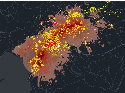
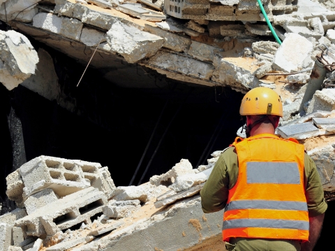
Across the United States, GIS technology is also helping address one of the biggest challenges during and after disasters: a lack of communication among emergency planners, first responders and search and rescue teams. To streamline coordination on the ground and in the air during rescue efforts at a 2021 high rise collapse in Surfside, Florida, rescue workers used the new Search and Rescue Common Operating Platform (SARCOP) to integrate operational planning and field data with a real-time map. Near-real-time drone imagery of the rubble was turned into 3D models, helping identify areas where victims were most likely to be found.
SARCOP is maintained by the National Alliance for Public Safety GIS (NAPSG) Foundation in close collaboration with government agencies, using Esri’s ArcGIS platform. NAPSG Foundation also promotes training on the platform and supports over a hundred urban search and rescue exercises every year.
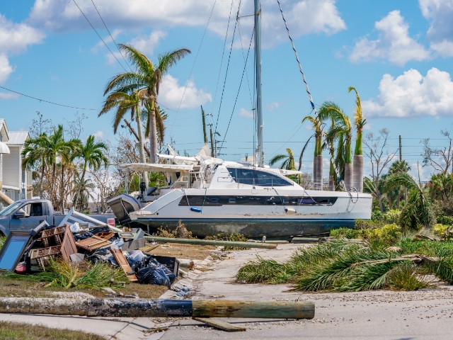
These collaborations and trainings were paramount after Hurricane Ian hit Florida in 2022. SARCOP helped rescuers find boats washed up by the storm and assess whether they were likely to be residential vessels with people inside. Similarly, the platform was used again in the rescue work during and after the 2023 floods in Vermont. The location intelligence enhancements developed in these crises can be implemented to conduct more effective search and rescue work around the country.
Resiliency built on preparation
After a disaster, geospatial analysts can use the same data to provide detailed damage assessments of affected areas, which ultimately helps expedite government support to those impacted. Other geospatial data can be fed into public dashboards, directing residents in affected areas to the nearest aid and food.
GIS technology can also help minimize the impact of a disaster before it strikes by helping decision makers better understand the environmental, economic and social factors that make communities more vulnerable. Where these factors intersect is where disasters hit the hardest, and where emergencies can turn into calamities.
“Often that tipping point is available to us to understand by just asking good questions that look at not just demographics, but also where people maybe have lack of access to transportation or lack the means to purchase insurance that can help them recover more quickly,” said Lanclos.
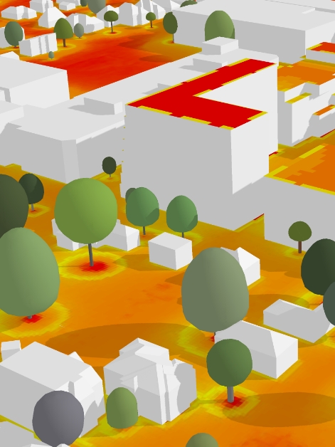
One emerging approach to disaster preparation involves using GIS technology to model future impacts with detailed, interactive 3D maps called digital twins.
“When we start to look at that level of detail, we can…plan much more targeted interventions that mitigate future risk, and also adapt in a changing world to make sure that we can move forward—where to plant trees for heat islands, where to adapt building codes and structures for floods,” said Lanclos.
“What we see in these disasters and events is that the past is not a good predictor of the future. This is where technology and tools like GIS allow us to have better insight, and hopefully avert disasters.”
Ryan Lanclos, Esri
Lanclos pointed to the thick veils of smoke from Canadian wildfires that spread to the United States in June 2023, breaking pollution records in cities like New York and Chicago, as a new type of crisis.
“What we see in these disasters and events is that the past is not a good predictor of the future,” he said, highlighting the acute need for data-based location intelligence. “This is where technology and tools like GIS allow us to have better insight, and hopefully avert disasters.”

Learn more about how Esri’s location intelligence can transform your organization’s decision making.